Insurance & Finance
We help insurance and finance stakeholders leverage Earth Observation, geospatial analytics, AI, and Explainable AI (xAI) to better understand and manage risk. We deliver EO-powered risk intelligence that supports more informed and resilient decision-making.

As climate-related and natural hazard risks become more frequent and severe, organisations across the insurance and financial sectors face increasing pressure to better understand and manage risk. With global insured catastrophe losses exceeding $100 billion annually in 2025, access to timely, transparent and data-driven risk intelligence has never been more important.
At SPACE-SHIP, we help insurers, reinsurers, banks, financial institutions, brokers and investors leverage Earth Observation, geospatial analytics, artificial intelligence and Explainable AI (xAI) to transform complex data into actionable risk intelligence. Our solutions improve risk visibility, support better decision-making, and increase confidence in AI-driven insights through transparent and explainable methodologies.
$107B
Expected global insured losses from natural catastrophes in 2025
11%
Annual expected growth in parametric insurance, driven by EO data
40%
The amount of insured weather-related economic losses globally in 2024
Our team combines expertise in Earth Observation, remote sensing, geospatial analytics, AI and Explainable AI (xAI) to help stakeholders make more informed decisions. We also support clients in integrating Earth Observation and AI into existing workflows, systems, and decision-making processes through consulting, technical implementation, and capacity-building programmes.
Outputs can be delivered as reports, GIS-ready datasets, dashboards, web portals, APIs, and automated monitoring services, while our team can work alongside internal experts to strengthen, integrate, and scale existing analytical capabilities.
We deliver tailored EO-powered risk intelligence solutions that help organisations better understand, monitor and manage risk. From climate and natural hazard intelligence to exposure assessment, portfolio monitoring, historical event reconstruction, claims validation, and parametric insurance applications, our solutions provide greater visibility into risk exposure while improving transparency, resilience, and decision-making.

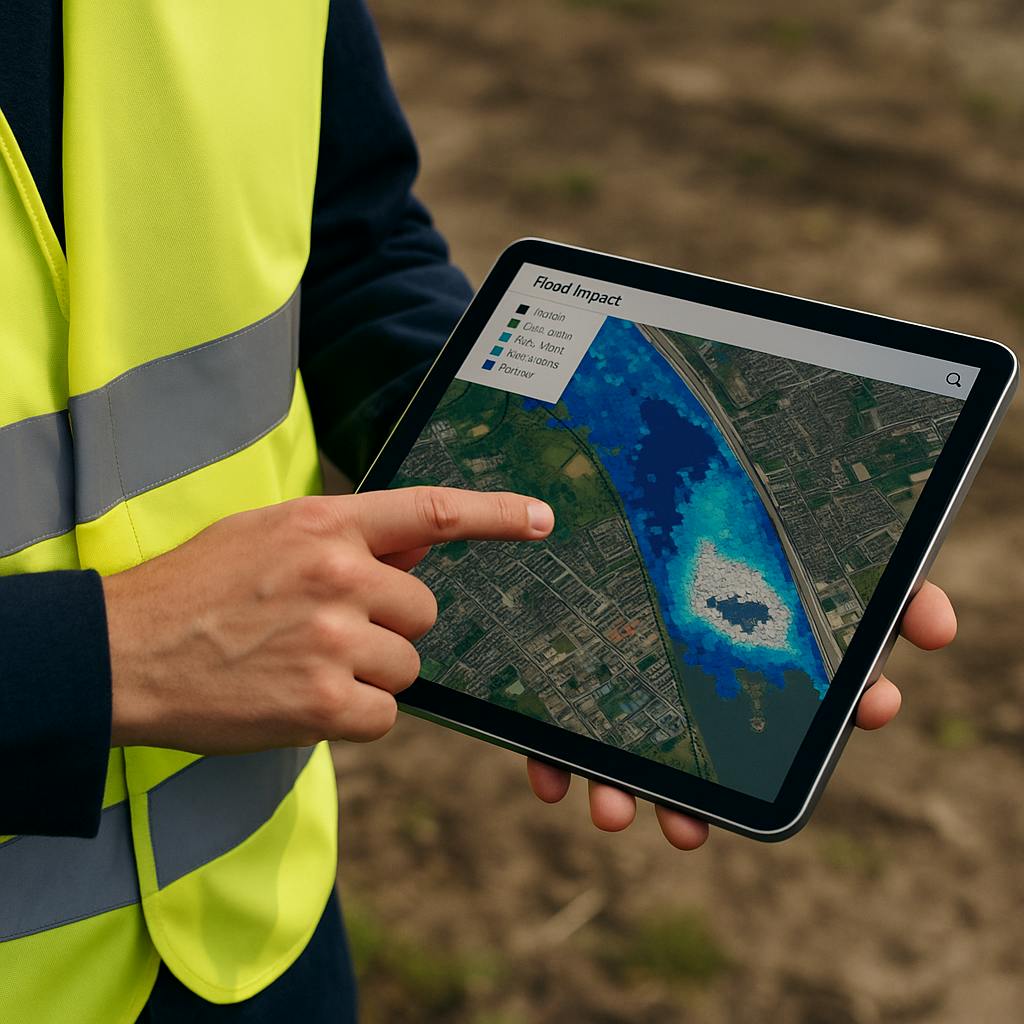
Climate & Natural Hazard Risk Intelligence
We help organisations assess and monitor exposure to wildfire, flood, storm, hail, drought and other natural hazards. Our solutions support underwriting, portfolio management, catastrophe intelligence and climate risk assessment to help clients understand long-term risk trends.
Exposure Assessment, Due Diligence & Portfolio Monitoring
We help organisations identify risk concentrations, evaluate assets, and monitor exposure across large portfolios. By combining Earth Observation data with client-specific information, we support due diligence, risk screening, portfolio monitoring, and climate-related risk assessment.
Explainable AI for Risk Intelligence
We develop Explainable AI (xAI) solutions that help organisations understand not only what a model predicts, but also why. This increases trust, transparency, and confidence in AI-driven decision-making while supporting governance and responsible AI adoption.
Historical Event Reconstruction & Loss Analysis
Using up to 10-15 years of satellite, weather and environmental data, we reconstruct historical events to provide objective insights into past hazards and their impacts. These capabilities support claims validation, catastrophe analysis, post-event loss tagging for mortgage and asset portfolios, and long-term risk assessment.
Parametric Insurance Products
We support the development of parametric insurance solutions using Earth Observation and environmental intelligence. By monitoring measurable environmental indicators, organisations can improve preparedness, automate response mechanisms and develop innovative risk transfer solutions.
EO & AI Capacity Building for Risk Intelligence
Many organisations recognise the value of Earth Observation and AI but face challenges in understanding how to apply them effectively. We provide tailored workshops, trainings and executive briefings that help build internal expertise and increase confidence in AI-driven insights.

Copernicus, Landsat, MODIS, CEMS, CHIRPS, HydroSHEDS, SRTM, National Disaster Datasets, Artificial Intelligence (AI), Explainable AI (xAI), Google Earth Engine, QGIS, Python, FastAPI, APIs, Dashboards, and Cloud-Based Analytical Systems.